Topology Errors

28 August 2006

Denial is Not Just a River in Egypt

Dimitri’s comment is interesting enough to send down the RSS feed in its entirety.

Hi Chris,
Thanks for featuring me in your blog. I'm very flattered you would take the time to track down and include my picture. You don't have any actual content in your log regarding my writings that I could see (it would be good form to link to, say, a synopsis and a rebuttal), so I have no way of knowing what you agree with or disagree with. I take it that you do have some views on GIS. But if you fail to articulate those in a cogent way you do nothing but provide yet more search engine links to my writings. I've written a lot over the years so I don't know what you are getting heartburn over, but at least I have always had the respect for my readers to take the time to set forth an argument to the best of my ability at whatever level of detail was required to make my case. You may not agree with those writings, but you appear to be taking the lazy man's way out of failing to address the substance of my writings. If there is polemic in play, it is on your side and as a result of your failure to discuss the issues with whatever technical or business expertise is required to do them justice. So, if you are going to bother to cite my writings and indicate disapproval, do yourself a favor and take the time to write a rebuttal that computer professionals (or simply the intelligent general reader) can read and decide for themselves whether you have a valid point. But, if you cannot do that, I suppose I should be grateful that you would provide greater visibility for my views with whatever web of links your blog puts into play.
Regards, Dimitri


#1 This blog comments on the mores and customs of the GIS community, not the technology or application of GIS. As such, it is for people who understand that personal relationships are vitally important in business.

#2 I noticed you didn’t address the suggestion to quantify Manifold’s success in the marketplace.

#3 Your writings stand on their own and don’t require a formal rebuttal. The passage of time is sufficient to give the computer professional or even the lowly (in your mind) intelligent general reader an opportunity to evaluate their reliability. I’ll cite from your presentation to the Emergency Information Infrastructure Partnership (EIIP) in August 1998.

I figure by this time next year Manifold will be outselling (in unit volumes) all other GIS vendors combined.

26 August 2006

It Takes a Village (Reprise)

Before any comments arrive, I understand the irony of mentioning the Dimitri incident since I set myself up to “wrestle the pig”. Nevertheless, I started this blog to point out the sensationalism of a vocal minority so it comes with the territory. The good news is that the village has grown in the past year and it is more thorough than any single individual so I rarely feel the urge to post. Hopefully, my previous post brought a few smiles and caused others to pause and reflect.

Since I expect a reply from Dimitri, I suggest that he quantify his comment, “the company has so much money flooding in that …” As someone involved with procuring enterprise software, I’d like to know the level of the flood waters and how fast they’re rising before I reallocate resources.

It Takes a Village to Raise A …


I’ve been stirred awake from my five month siesta to document the latest Dimitri Rotow sighting outside of the Manifold-Davidian Compound in Mount Carmel Center, Texas. Err, I mean Carson City, Nevada. The comments on James Fee’s blog just keep piling on.

It’s nostalgic since a Dimitri rant was one of the primary drivers for starting Topology Errors. I referred to Dimitri as the Unamapper in a post last year since his writing reminded me of the Unabomber Manifesto. At that time, I didn’t know that Dimitri (age 51) and Ted Kaczynski (age 64) were both Harvard graduates.

The comment trail with Dimitri’s conduct and the upshot reaction fascinates me. It’s like observing a mystical creature carve out an existence within a hostile environment. Frankenstein versus the villagers is the image that comes to mind. I simply had to learn more about Dimitri. A Google search yielded an eight year old photo and short bio.

It would be entertaining to pile onto the comment list and point out logic errors (both Dimitri’s and others) and use phrases like Jump the Couch or Goodwin’s Law. But I won’t since the villagers are handling that job.

After I finished reading the comments, I was a bit disappointed in myself for wasting time with my prurient interest. In contrast, I admired those who decided not to join in and “wrestle the pig”.

But upon further reflection, this incident shows the value of the GIS blogosphere as a village. This discussion has value once you strip out the hyperbole. Different beliefs become articulated. The village embraces some and challenges others. Most established or honorable press won’t touch this sort of topic because of the mud involved.

But the village can address this type of topic. Participants who use the discussion to examine their beliefs and test their assumptions win since they learn and grow. Those who don’t learn and grow appear stiff and inhuman. And the village decides who is the sage, who is the fool, and who is the menace.

Note: I only moderate comments to filter spam and haven’t yet modified or deleted a single one related to the discussion.

13 March 2006

Jumping the Shark--Who's Next?

"Jumping the Shark" is a term for identifying that exact point in time when fans of a show or subscribers to a publication realize (in retrospect) that the show or publication has passed its peak. In a previous post, I identified a printed editorial in GIS Monitor from Feb '05 as a watershed event. Looking back, that editorial is when GIS Monitor "jumped the shark" for me. I unsubscribed around that time and haven't heard much conversation about them in the blogosphere. So I wonder, "Has anyone else jumped the shark? Who's next? Who is on skis skimming across the water with flair? Who is donning their flotation device?"

Note: Even before the comments come in I'll admit to jumping the shark with "Interesting Versus Useful". The good news for me is that I am an "amateur" at this GIS blogging stuff and love my day job. This isn't my first blog and it isn't my last. (But it is the last where I'll use Blogger.)

12 March 2006

Authority - Part 2 (Established Geospatial Press vs. Blogosphere)

Most of the established geospatial press (that which existed before 2005) rose to prominence because they were the independent voice in an arena of competing vendor claims. Examples include Directions Magazine, Geospatial Solutions, GeoWorld, GIS Café, GIS Monitor, and GIS User. In general, their editors lack in-depth knowledge of current technology at the nuts-and-bolts level. Communicating is their full-time "professional" job. In order to write analysis and commentary, they review company pronouncements, read their competitors' analysis, monitor blogs, attend conferences, conduct interviews, and play with geospatial software on their personal computers or small labs.

In contrast, the everyday job of the GIS professional is using current software tools for data acquisition, data automation, maintaining data, creating metadata, making useful maps, distributing maps, conducting geographic analysis, reporting results, training, and keeping the system running when upgrading hardware and software across the organization. They know more about how these tools work in the real world than even the software companies that create them. When GIS professionals enter the blogosphere as an "amateur" communicator and each contribute a few hundred words a week, they carry more authority than the "professional" GIS press and analysts. At some point, the collective group of "amateur" communicators will outweigh the "professional" GIS press and analysts because the "amateurs" are the bona-fide authorities.

So, what is the long-term future of the established geospatial press? They've got an established subscriber base and revenue stream from advertisers. It will be a while before everyone uses RSS aggregators so their immediate prospects are not dim. Software like Google Earth and NASA Worldwind are making more people aware of mapping and GIS so their subscriber base may grow in the near term. As a result, I'm not certain of the long-term future of the established geospatial press. But, I think a lot of people don't care because they already get more timely and knowledgeable information from the blogosphere. It's as simple as adding Planet Geospatial into your RSS aggregator. Thanks again James!

11 March 2006

Authority - Part 1

I finished Naked Conversations and experienced a few epiphanies in the final chapters. The first surrounds the idea that the two most fundamental rules for blogging about a subject are passion and authority. Regarding authority, Shel Israel and Robert Scoble give the example of Bob Lutz's blog on p. 51. Bob is the GM Vice Chairman and author of the Fast Lane blog. So for about 150 pages, I'm thinking that there isn't much opportunity for blogging in the geospatial realm because not many people are in a similar position to Bob Lutz. Yesterday I figured out that authority on a subject doesn't come from a title or position. Rather it comes from insight and understanding. It's the old, "knowledge is power" thing. It's the reason a blog can pop up and gain an instant following such as Drkside of GIS as a recent example. Up to this point, we hadn't heard from a Java programmer who wasn't a geo-geek. OK, so authority in the blogosphere comes from really knowing the subject at both the conceptual level and the nuts-and-bolts level. More about this in future posts. Gotta run, it's the weekend.

07 March 2006

Unprofessional and Undisciplined - December Comment

On Dec 20, Charles Greer added the following comment:
This is a pretty old thread, but then again I feel like I just discovered the GIS blogosphere, and I think you two have hit on some really interesting things here...

I'm in a job where I adminster ESRI products daily, and I find a great deal of tension between established enterprise software, such as databases and web apps, and GIS apps. ESRI seems to have created the flagship desktop product. But they have a great deal of difficulty tackling the idea of the enterprise. In developing enterprise apps, it seems time and again it's the simple solutions, such as Google's circumvention of dynamic vector rendering, that really have the bang for the buck in spatial technology. I think that ESRI's ArcGIS server is woefully too complex a program to really address the really very simple spatial needs of a large business.

I'm able to turn heads daily by leveraging DB2's spatial Extender, and I'm SOOOOO thankful that my employer went the route of getting a real spatial RDBMS. And I cringe whenever I'm forced to jump through all the interface hoops that ArcGIS gives me.

That said, howzabout my website's professionalism? It is tough for intelligent malcontents to buckle down and act professional. I try, but the most rewarding moments are when two people can realize they are able to sit down and go past all that for a while and simply get some interesting stuff done. That said, endless rants are usually boring, and I hope I've not simply thrown one at ya.

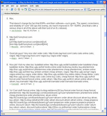
Thanks again for the comments. The only reason I moderate comments is to remove spam. Check out the comments at the bottom of Berlin's original post and you'll see what I want to avoid. And just to keep score, Berlins initial attack was 205 words, my rebuttal was 229 words, James White's comment was 262 words, and Charles Greer comment was 255 words. One thing about the blogosphere is there never seems to be the last word. Regarding IBM DB2 Spatial Extender, I remember hearing that it is an OEM version of ESRI's ArcSDE.


(Update: About five days after my post all comments were removed from Berlin's original post. Thanks to Google cache I can provide a screen capture of where the real comments ended at #5 and the spam comments started at #6. In fact, spam comments went through #51.)