Unprofessional and Undisciplined - December Comment
This is a pretty old thread, but then again I feel like I just discovered the GIS blogosphere, and I think you two have hit on some really interesting things here...
I'm in a job where I adminster ESRI products daily, and I find a great deal of tension between established enterprise software, such as databases and web apps, and GIS apps. ESRI seems to have created the flagship desktop product. But they have a great deal of difficulty tackling the idea of the enterprise. In developing enterprise apps, it seems time and again it's the simple solutions, such as Google's circumvention of dynamic vector rendering, that really have the bang for the buck in spatial technology. I think that ESRI's ArcGIS server is woefully too complex a program to really address the really very simple spatial needs of a large business.
I'm able to turn heads daily by leveraging DB2's spatial Extender, and I'm SOOOOO thankful that my employer went the route of getting a real spatial RDBMS. And I cringe whenever I'm forced to jump through all the interface hoops that ArcGIS gives me.
That said, howzabout my website's professionalism? It is tough for intelligent malcontents to buckle down and act professional. I try, but the most rewarding moments are when two people can realize they are able to sit down and go past all that for a while and simply get some interesting stuff done. That said, endless rants are usually boring, and I hope I've not simply thrown one at ya.
Thanks again for the comments. The only reason I moderate comments is to remove spam. Check out the comments at the bottom of Berlin's original post and you'll see what I want to avoid. And just to keep score, Berlins initial attack was 205 words, my rebuttal was 229 words, James White's comment was 262 words, and Charles Greer comment was 255 words. One thing about the blogosphere is there never seems to be the last word. Regarding IBM DB2 Spatial Extender, I remember hearing that it is an OEM version of ESRI's ArcSDE.
(Update: About five days after my post all comments were removed from Berlin's original post. Thanks to Google cache I can provide a screen capture of where the real comments ended at #5 and the spam comments started at #6. In fact, spam comments went through #51.) 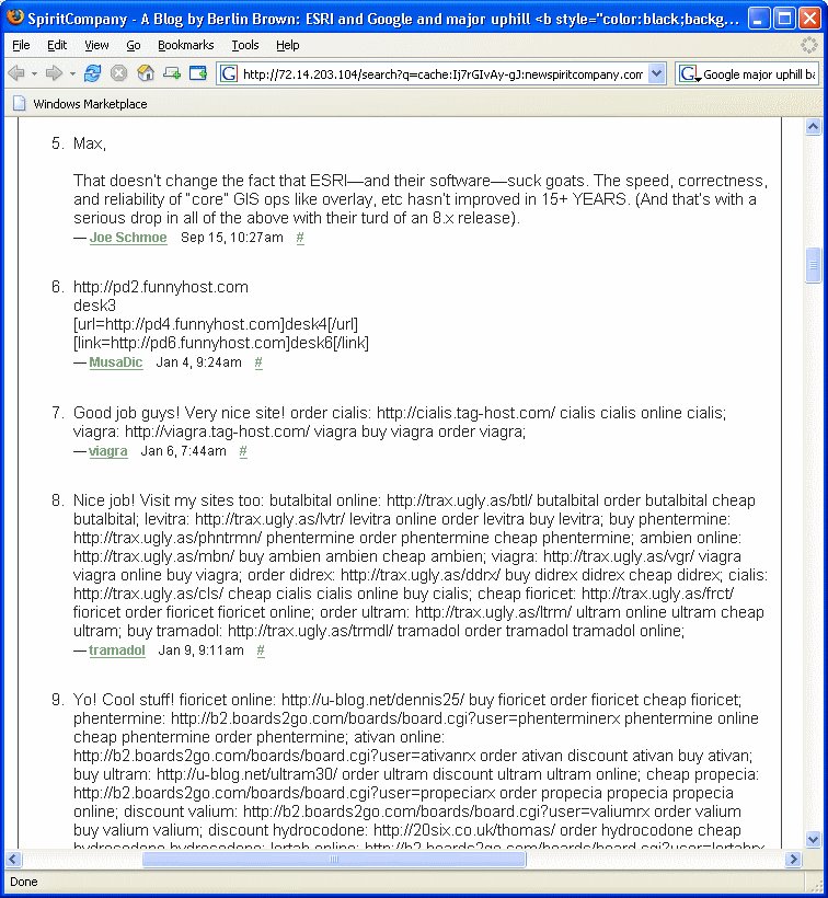
posted by Chris at
05:31
![]()
![]()
